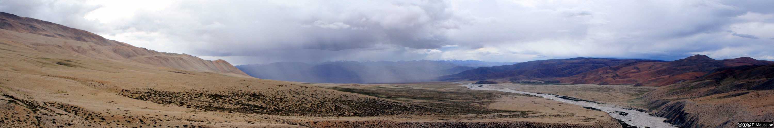

From Skaftafell to Hverfisfljót, Day Three
Skeiðarárjökull – Grænalón
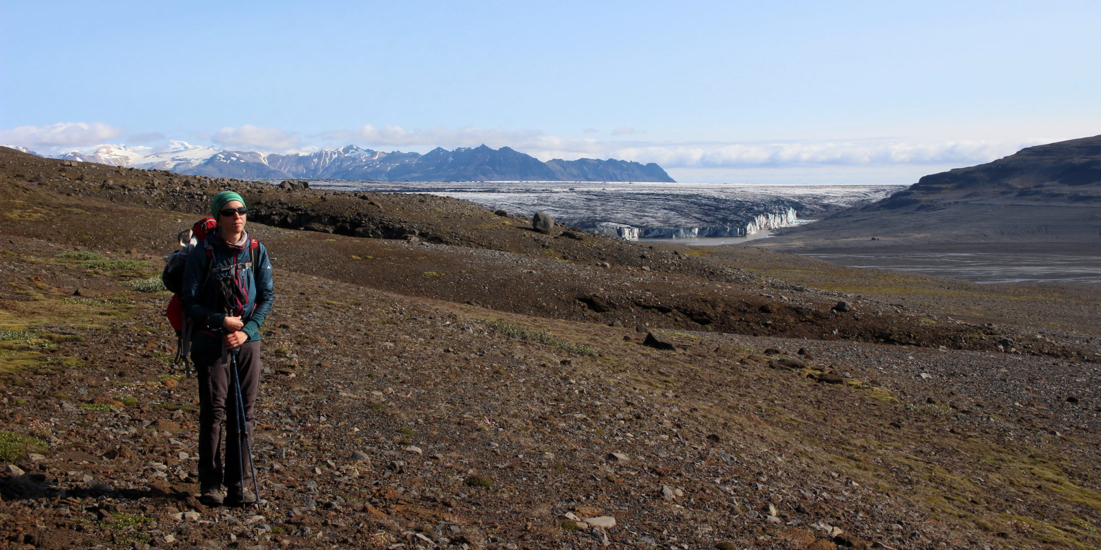
Again, no wind has tested our provisionally pitched tent. We hadn’t set an alarm because neither of us was in a hurry to be confronted with the mess we’re in. Slowly, slowly we’re having breakfast today. Slowly we’re getting changed, it’s close to 9am already. Reluctantly, Conni leaves the tent first for brushing her teeth – and surprisingly finds herself absolutely enjoying the view, the warm sunshine from a completely blue sky, the surreal surroundings, the ash she’s standing in. Looking out to the West over the black giants in her way she feels bold and optimistic. There are only 4km between us and the western edge of this forsaken glacier. It will need a bit more than a hell of ice and ash to make us turn around now! Oh how a good night’s sleep can change the world. Somehow, sleeping like babies right in the middle of, in fact, right on top of our fears and doubts made them go away. With expert eyes we’re now scanning the mountain ranges that stretch out to both sides in front of us. Sighting a slight decrease in height and softer slopes of the ice pyramids further up the glacier gives us enough confidence.
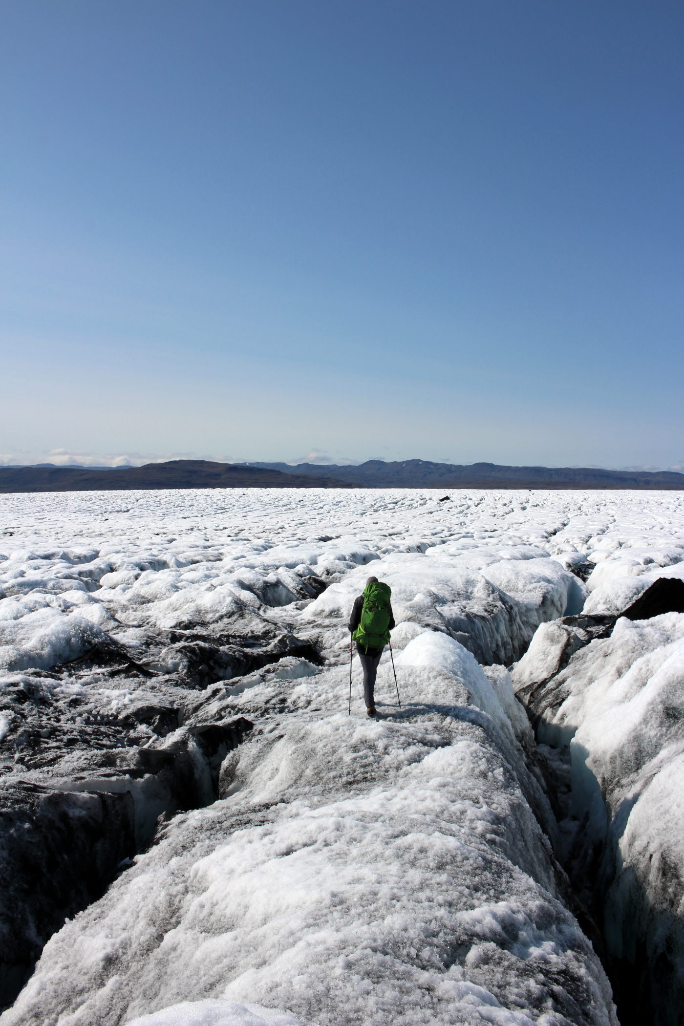
We pack our stuff, roll up the tent and we don’t need a long discussion. “What do you think? Should we try again 1km north from here?” asks Fabien and off we go. We leave the Black Forest to take the ash highway running in parallel. We cover the distance northward in no time and almost immediately find a friendly pass leading us over the first row of ash mountains. And the second row. Conni can’t stop grinning. What looked intimidating to us yesterday is now something that we feel can easily be climbed. The crevasses are smaller, allowing lateral search for suitable passages. Climbing up the big ridge over there? Not a big deal today. The shapes of the ice mountains often resemble miniature copies of their bigger counterparts made of stone. We wiggle through ice valleys, water carving blue rivers with black banks of ash. Without any difficulties we’re passing the third row of black mountains, sliding down its ashy slope on the western side. Conni has tears of joy in her eyes - we made it! We made it!! Fabien doesn’t want to make the mistake of too much optimism again and reminds her that we’re not off the glacier yet. Conni doesn’t care. From now, she is sure, it’ll be a piece of cake!
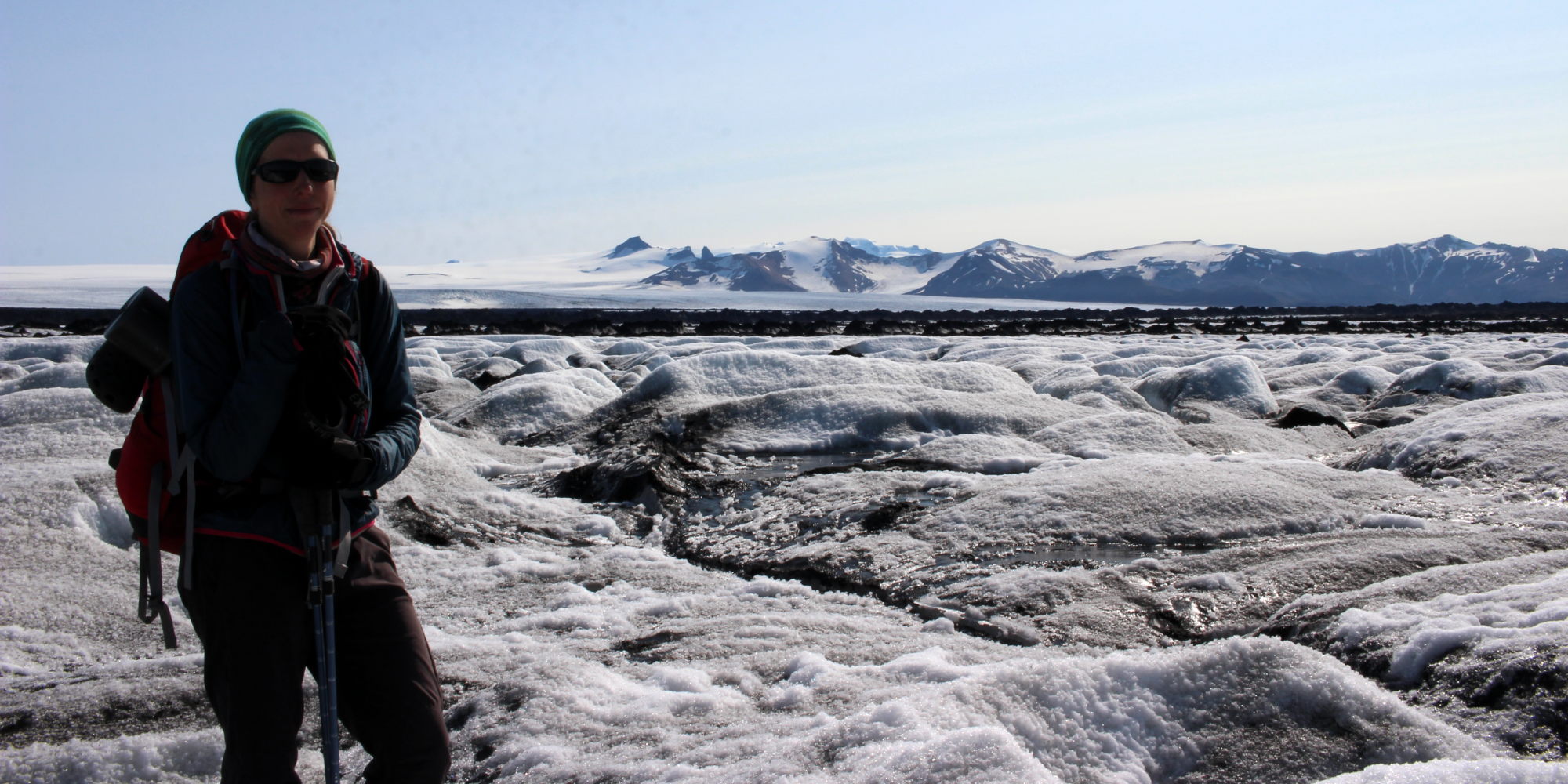
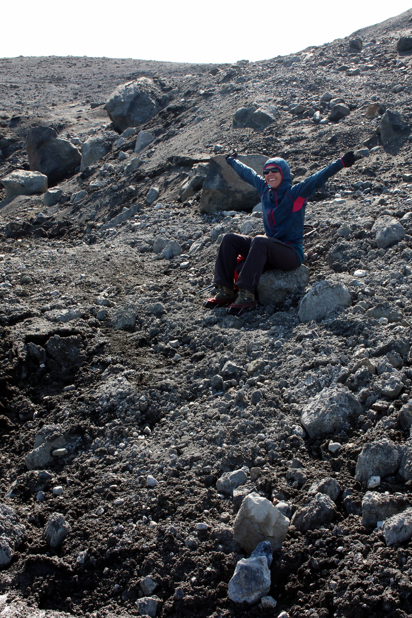
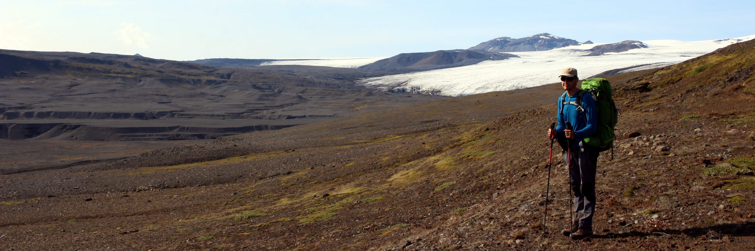
And it is. Except for the strenuous passage through the Black Forest our route was a very good choice. With all crevasses now running in parallel to our direction, we can avoid awkward continuous crossings of crevasses and instead are able to follow along the ice slices. Easily bouncing up and down the beloved ice bumps, we reach the western edge of Skeiðarárjökull. Throwing off her crampons, Conni lets off cries of victory. There you go, you monster!! We escaped, you couldn’t hold us back!
Finally we can continue our way on solid ground, passing what is left of the glacier lake Grænalón. This huge lake lost most of its water due to the retreat of the glacier, opening the barrier and giving way to an almost complete discharge along the western side of the glacier. What is left are high terraces of sand indicating past lake levels, like a staircase for giants dominating this landscape.
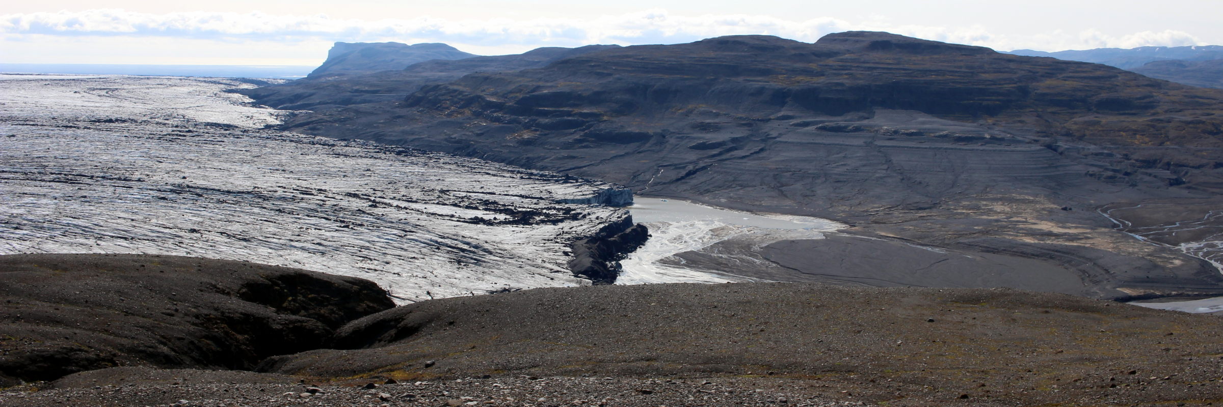
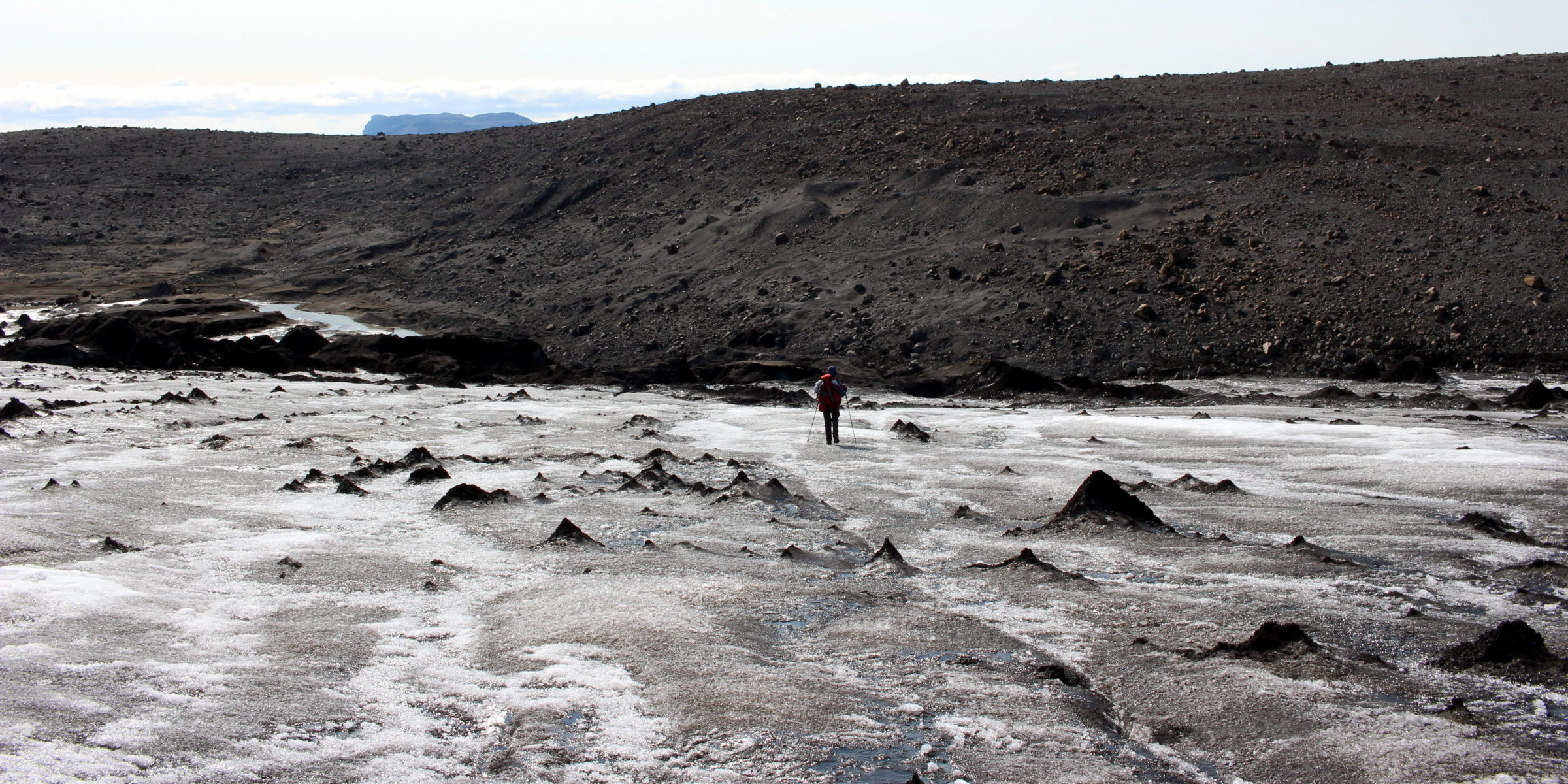
With the euphoria of the successful glacier traverse fading, Conni has time to find new reasons to worry. “You know what”, she says, “I think now we’ll be trapped between this glacier and some frightening glacier river. You’ll see.” - which would turn out to be quite correct. Following footprints of mountain guide groups along the Grænalón banks we can already see the river that would be the cause of the most dangerous situation on this trip.
Innocently glittering in the sunshine, we see it fanning out in several big streams in what used to be the lake. We knew we would have to cross it somewhere and this would have been our moment to cross it where it’s spread out in a wide flat terrain. But that would’ve meant to climb down all those giant stairs - and up again. In addition it was hard to tell whether the old lakebed might be muddy to the degree of sinking in.

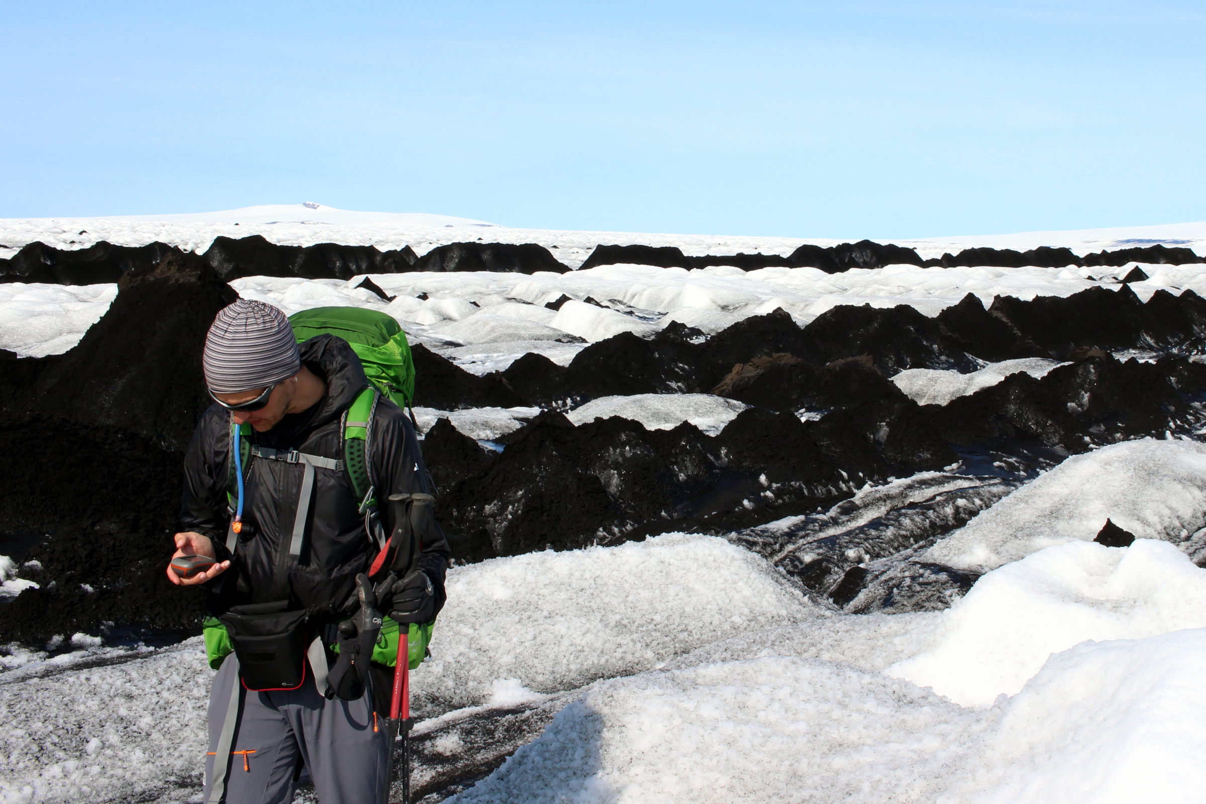
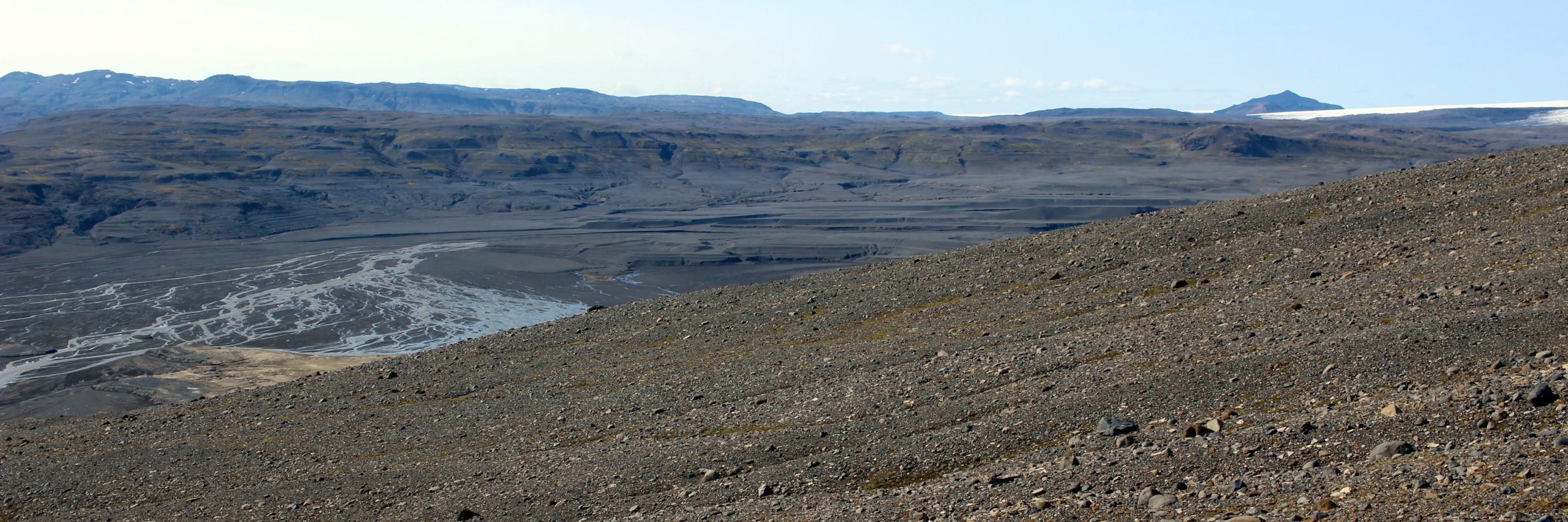
In any case, we trust our GPS track (and some more footprints here and there), which suggests that this river can be crossed further upstream. So we head several kilometres further upstream - but of course the river doesn’t become any friendlier. When we arrive at the point of the river crossing according to our map and GPS, we’re standing in an area where the river is deeply carved into a small valley with mostly steep slopes and only very few points that would allow a traverse at all (if you planned to actually be able to get out of the river on the other side). Ugh, how we missed that sick feeling in our stomach. We walk up and down our new grey-murky gurgling obstacle, not able to enjoy the tumbling masses of water in the rapids, let alone the cascade right behind the would-be crossing point. The sound of a river usually tells you what to expect when trying to cross it and the sound of this glacier river pretty clearly stated “stay away”.
We instantly decide to camp on the river bank. At least there would be less water in the morning and we absolutely don’t feel like dealing with a problem of that margin the same day we survived the Black Forest. It’s pretty clear to us by now that this tour would be a continuous problem solving. The uneasy feeling of not knowing what kind of crazy challenge comes next would be our constant companion. Of course, the fact that we have no cell phone reception out here and couldn’t call for help if anything happened doesn’t ease the tension.

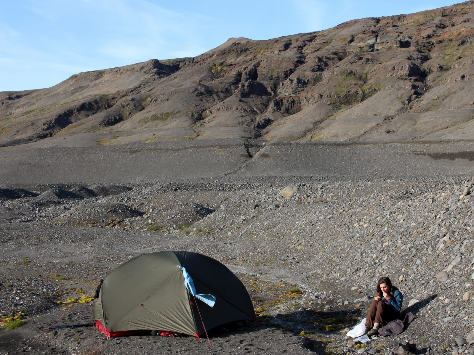
We try to make friends with the glacier river by going for a sponge bath (~shiver~) and testing our neoprene socks. Without socks our feet start hurting within seconds whilst with them the cold is barely noticeable for Fabien (Conni still starts to complain after several minutes.. thinner socks!!). We don’t want to think about tomorrow for now and Conni keeps herself busy with stitching up holes in her trousers (bloody crampons) whilst sitting in the sun by the tent. Let’s hope this river looks completely different in the morning…
If you plan to do the glacier traverse
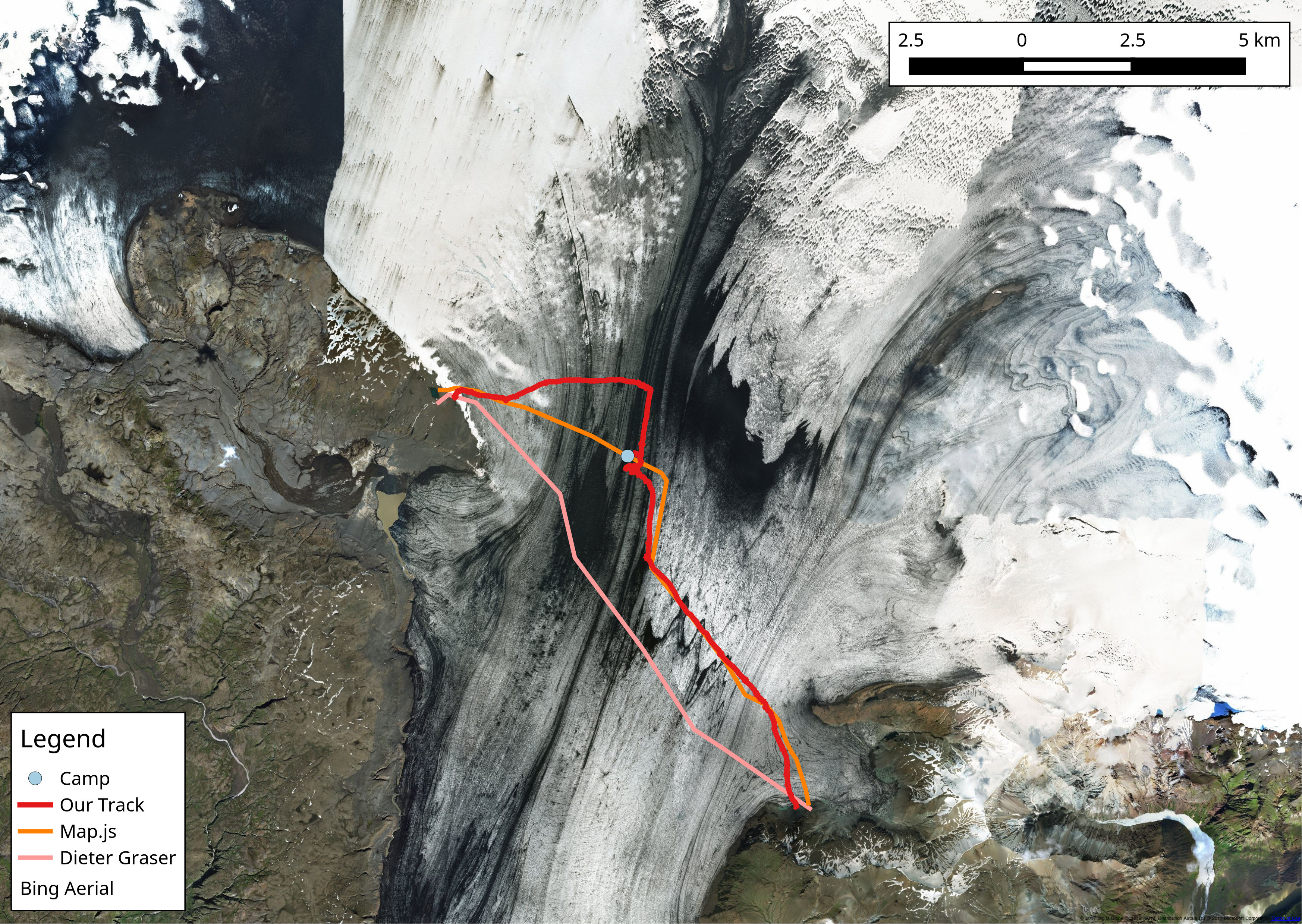
We knew from the hiking map that the guides now traverse the Black Forest much more to the North (orange line) than Dieter Graser did in 2006 (pink). We found it basically impossible to cross at the location suggested by both tracks, unless maybe by chance. Our solution (walking at least 1km further north than the suggested track) turned out to be quite good.
However, our route through the Black Forest might not be the best choice for the glacier passage to Grænalón. In hindsight we discussed potential routes passing way further south, avoiding the area completely. However, it’s worth to point out that a passage in the South necessitates redirecting northward behind the Black Forest in order to reach Grænalón. This passage leads through heavily crevassed sections in which crevasses mostly lie perpendicular to the track direction. We recommend to check Bing maps (yes, Bing maps, not Google, the latter is not up to date and the images are of inferior quality) for the current state of the glacier when you plan your trip. The satellite images show very clearly the direction of crevasses and the state of the Black Forest. And no, we hadn’t checked these images before our trip. But on the other hand we’re not sure we would’ve changed anything if we had, due to discussed reasons. A possibly much easier alternative might have been to change the itinerary and aim for leaving the glacier somewhere close to the GPS coordinates 64° 6.220’N, 17° 21.285’W. We would’ve missed Grænalón (but hey, it’s only a puddle now anyway) but we could’ve without problems headed north through Núpsá valley to hit the normal track again. Oh - and we wouldn’t have had to deal with the glacier river.